
Stephen K. Drake, PLS, CFedS
| JAVAD TRIUMPH-LS rover, TRIUMPH-2 base, with spread spectrum radio, and a set of pods I have hiked up mountains all over the country, even at a 115 degrees in the desert, thankful the whole set weighs less than my R8 tripod. |
|
|
Trimble R-10 rover, TSC3 controller, and R-8 base, with its bonus (heavy) tripod. (yea I want to hike that up the mountain for my setup…) The market heavy weights! (yea pun intended) |
We used to be Azule Land Surveying in Kingman, Arizona. We have relocated to the North Coast of California were the Redwood forests thrive operating now as Lost Coast Land Surveying out of Eureka, California.
Desert surveying has it’s unique challenges but really are light weights when compared to trying to obtain precise measurement in the coastal rain forests.
We are veterans of Land Surveying having experience in many jurisdictions, environments/eco-systems from the tropics in south Florida, upper Midwest forests, desert southwest, and Alaska’s arctic and coastal rain forest environments. 40 years of wondering in the wilderness to be sure. We have used most of the equipment and methods from the top vendors, including traditional methods which remain the normal methods used in this part of California for obvious reasons. 300’ tall trees and dense underbrush in coastal mountains make using anything else almost useless. One could almost remain competitive with a Gurley mountain transit and chain.
We have discovered though that where GPS is even remotely possible, the TRIUMPH-LS is far superior to any other system in it's ability to remain useful in this challenging environment.
Time after time finding it able to produce even when a competitor’s top unit failed. I’d like to share an experience I recently had.
Back ground: ALTA survey in Miranda, California. After living on the north coast for a year and half, I returned to northern Arizona for a 1 year tour, I then returned to the north coast to support a new local survey effort with a company whose experience was elsewhere. Expectations where a little off to say the least. I was task to complete the job using the companies standard Trimble equipment set-up which in their opinion was second to none.
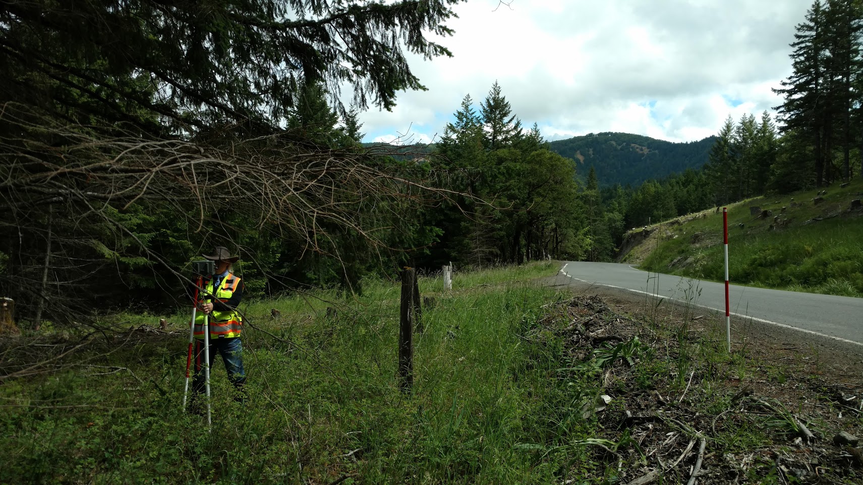
The site of this survey was 85% heavily wooded, mostly redwoods, steep terrain, and included a riparian boundary element, needing verification. Within an hour of being onsite I had the first monument recovered at the southeast corner of the parcel. I tried in vain to get a position with the Trimble R-10 in my arsenal.
Well being the boy scout I was prepared for this. Having been a part of the Javad Triumph beta program, discovering previously the benefit of this amazing machine in the forests, and desert mountains, already purchasing it, I carried it with me, just in case.
So I pulled it out knowing pretty much I would have a position somehow with it, but what’s more, I decided it was a stellar opportunity for me to do a side by side test.
|
The record parcel map from 1992 being retraced. Followed by the topo sheet from mine. |
|
We did a survey sheet but the topo sheet shows terrain plus most of the survey data, the company name is removed to protect the innocent, if any, since this was not recorded. You will see the southeast corner of the parcel, this being the first monument found, the controlling lines being the south line of the parcel and the tie to the 6x6 concrete right-of way monument to the south. We ended up within tolerance at 0.09’ and 0.11’ M vs. R. |
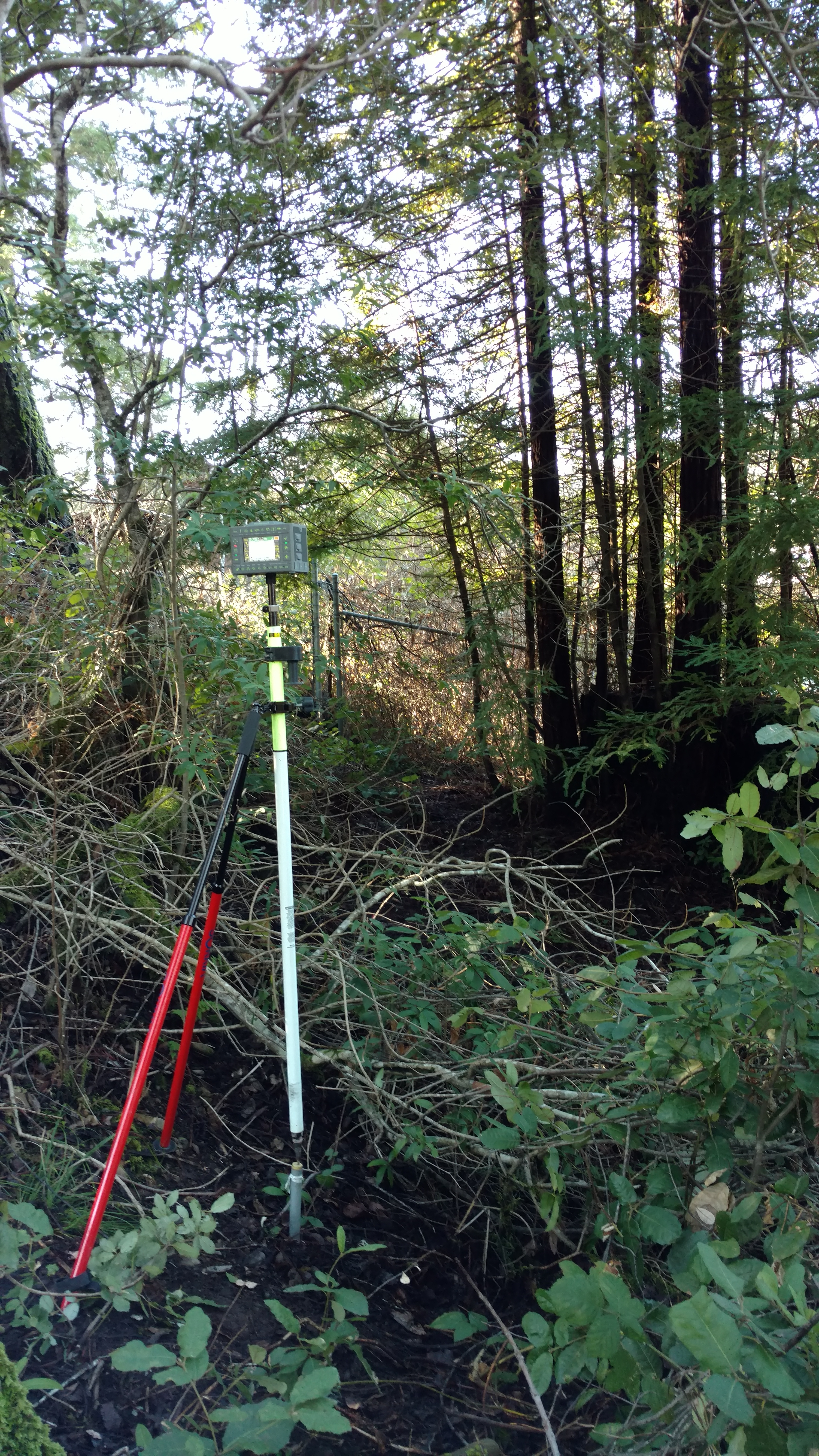
| R-10 occupying southeast corner. |

|
|
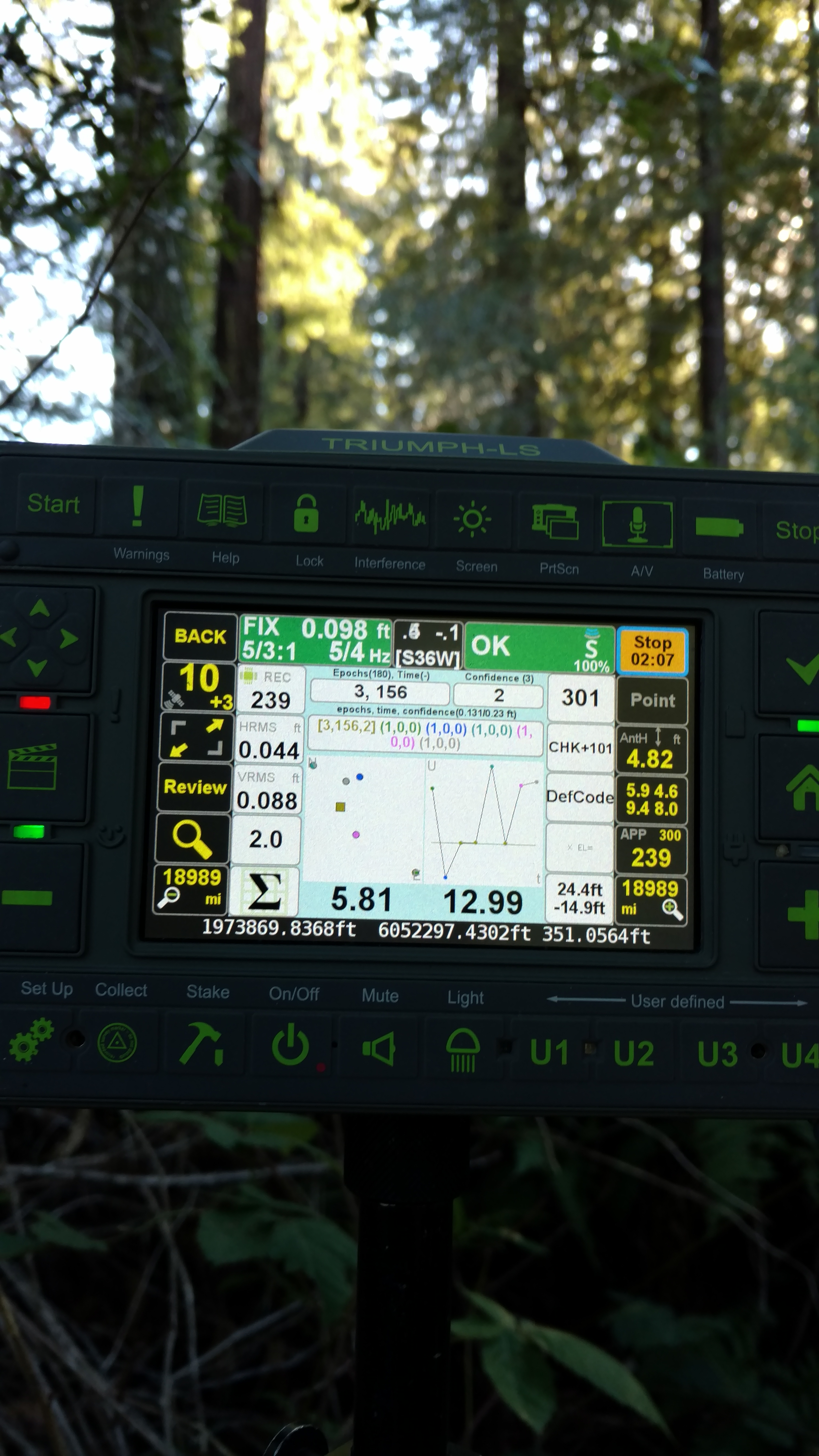
No fix! 1m18 waiting 180 remaining preset. |
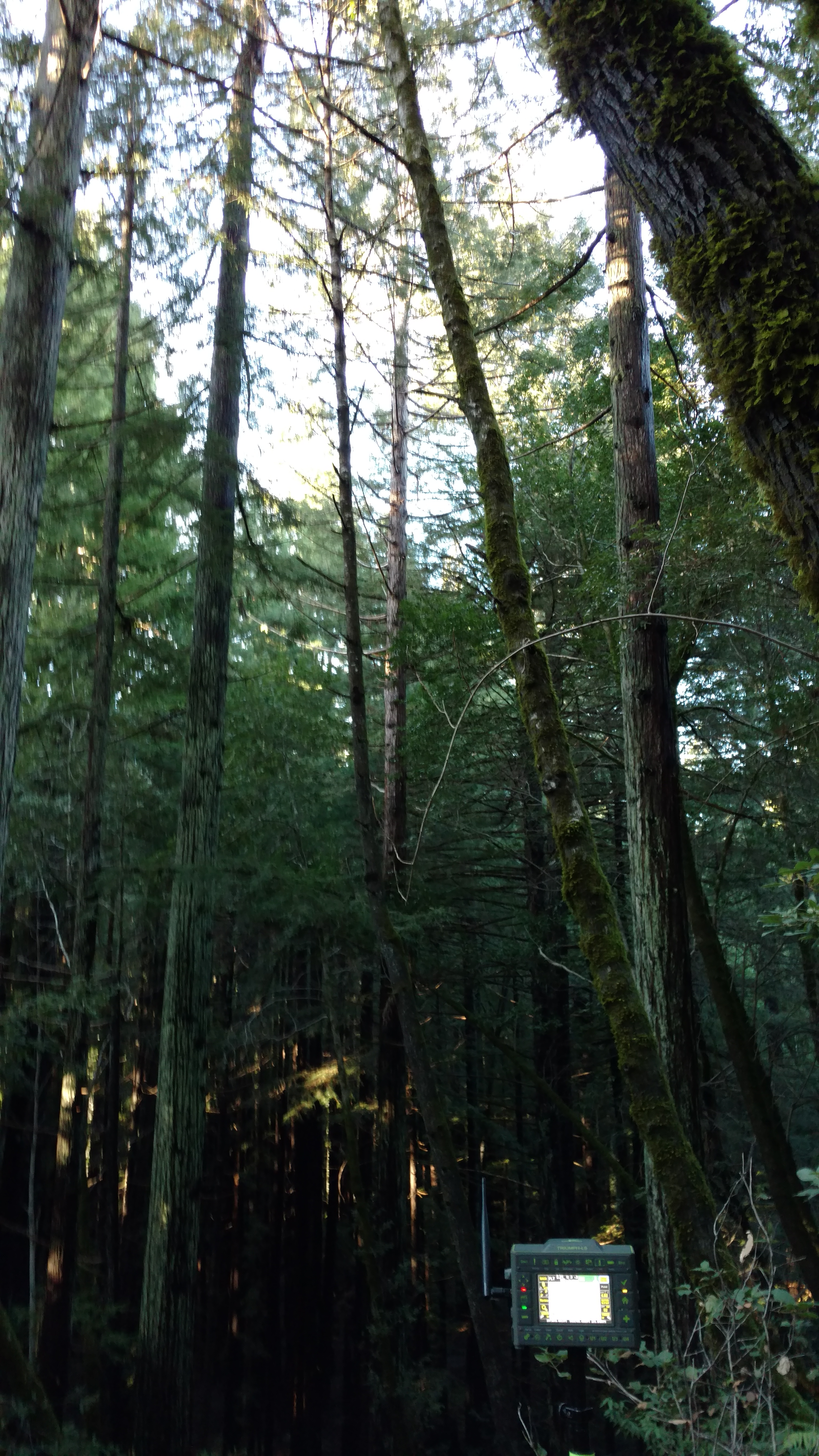
TRIUMPH-LS, same point. |
Fix! So with the TRIUMPH-LS I located the southeast corner of the parcel and verified it’s record ties to the southwest corner and 6x6 monument to the south. The R-10 could not locate any. |
| Shot at the southwest corner. We got it with hybrid RTK PPK! Thank you Javad! |
|
|
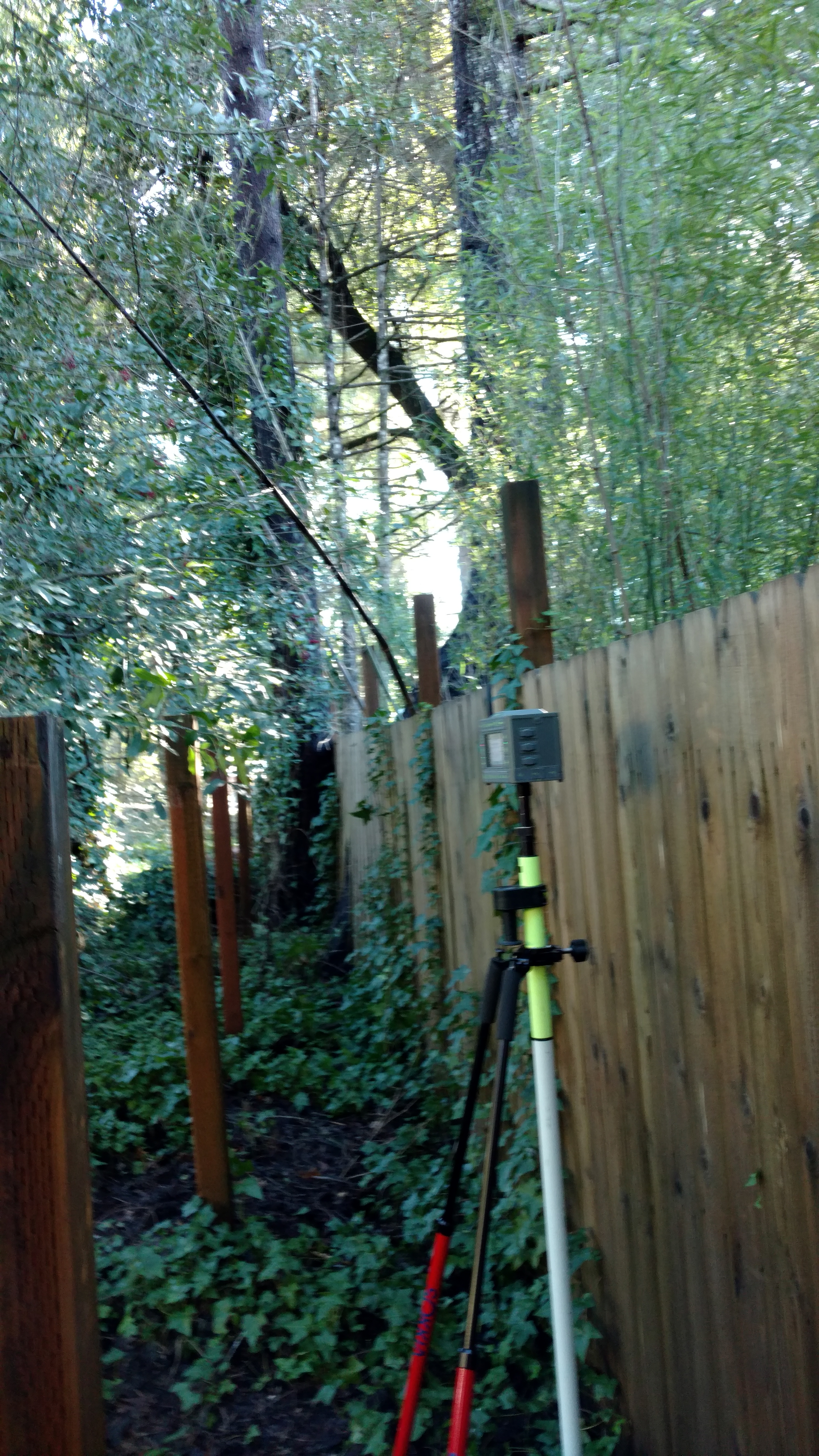
Shot at the 6x6 R/W monument. We got it RTK! |

|
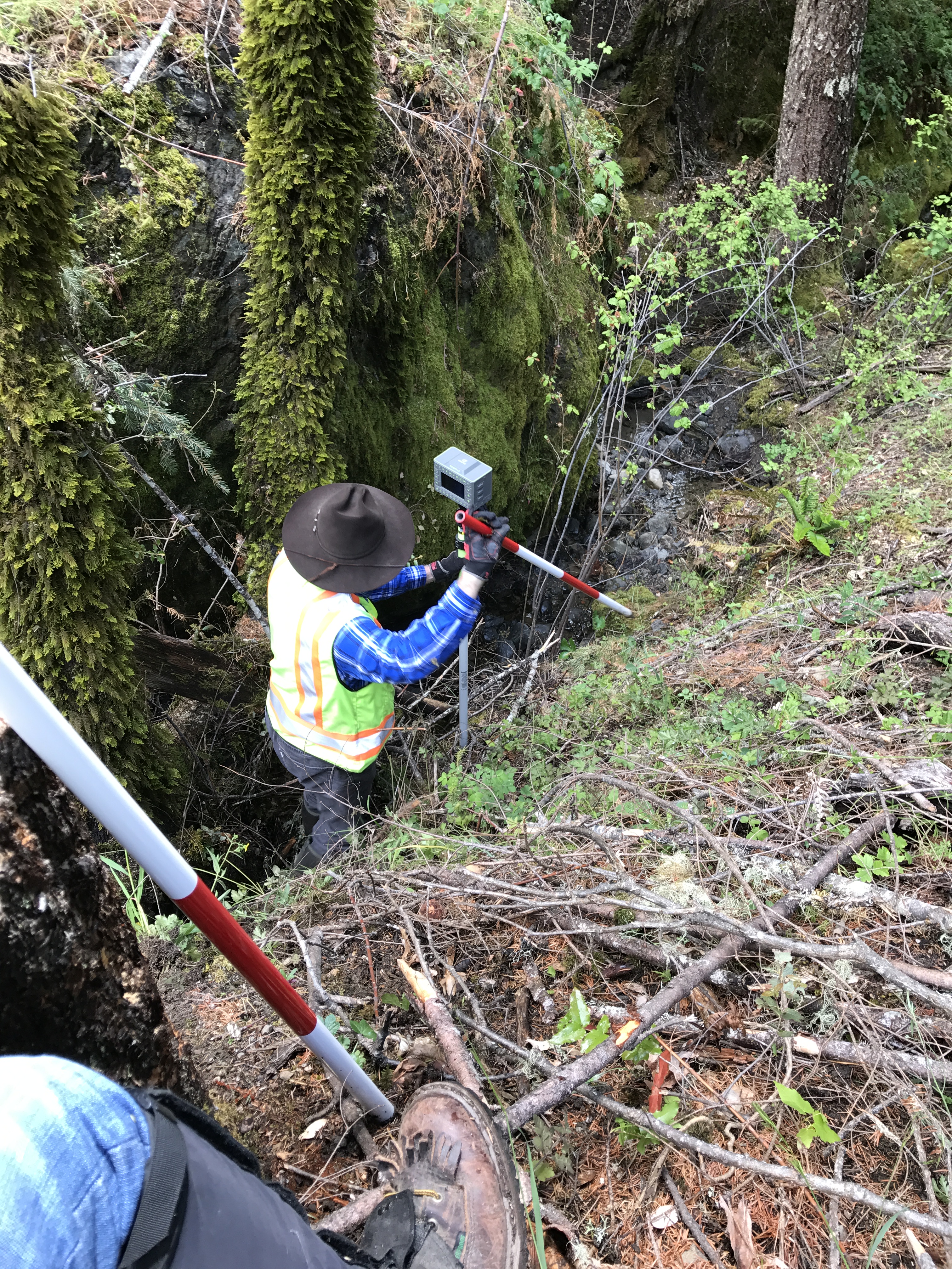
This is about 50’ up creek from the northwest corner of the parcel. The reference point is about the center of this photo. We got it! Hybrid RTK. The creek is seen at the lower left of the photo, which is our north line, and the terrain and trees the same all the way to road, or worse. Guess what? I located the creek and verified it to the record! Very rugged and tight canyon, but we got it! |
|
|
|
Down in a 60 foot deep canyon, we got it! |
|
JAVAD GNSS Note: Beware that R10 sytstem is much much more expensive than the TRIUMPH-LS system. TRIUMPH-LS not only saves your job, your money too. |
|